Ferme Le Grand UbacDrôme provençale, France
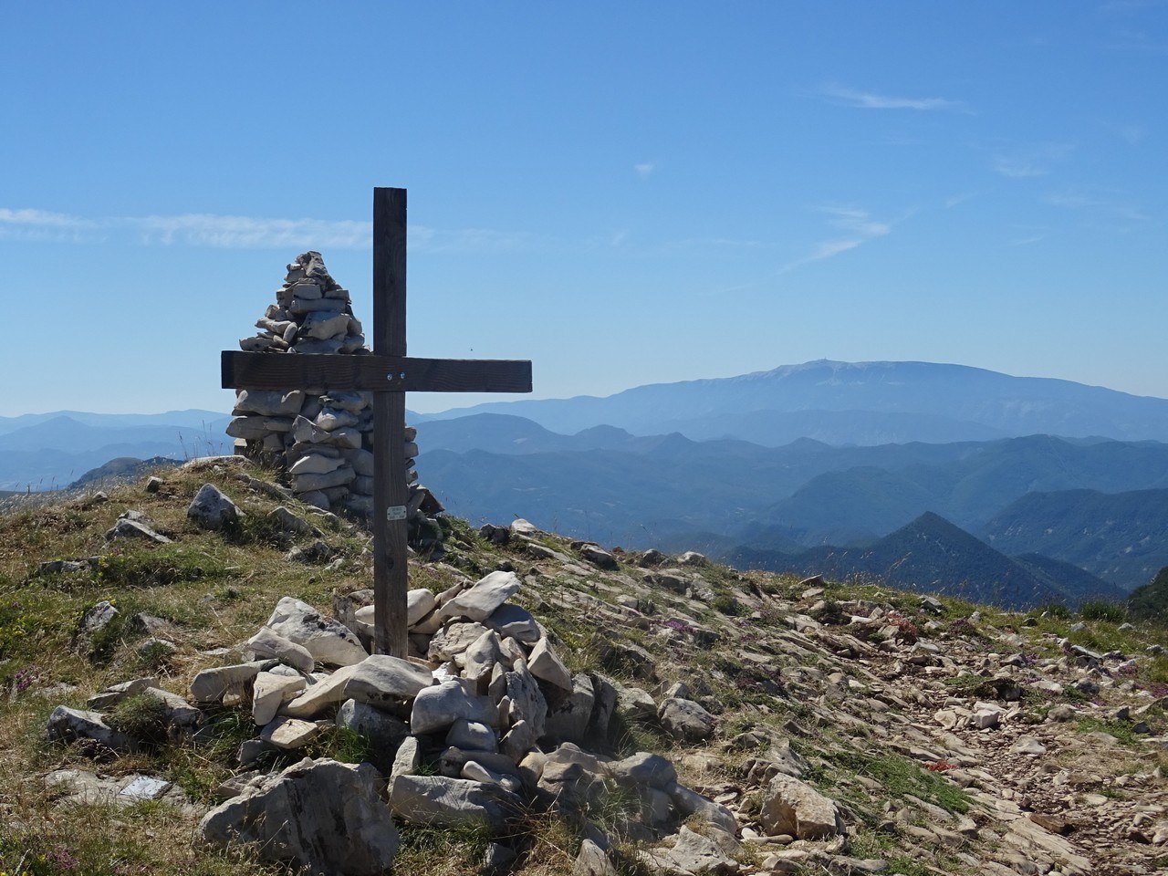
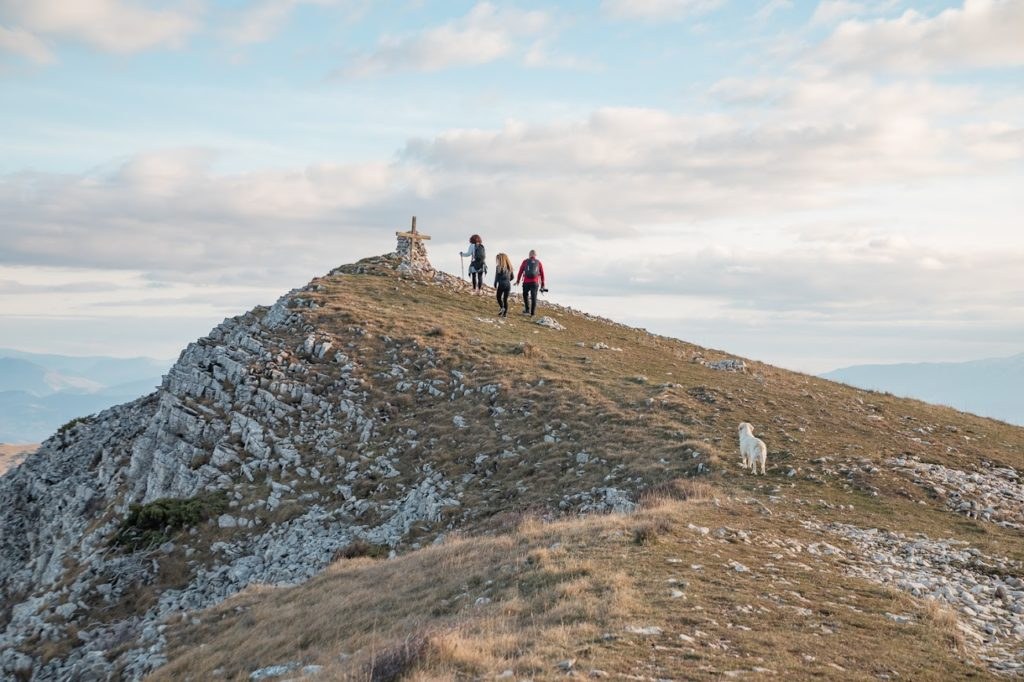
View from the summit ridge of the Montagne de la Lance, at 1,338 metres

Home  /  Activities  /  Hiking

Walking around the farm and up to the summit of the Lance

The ridge at 1,338 metres borders the farm's own commune. Three loops to climb it, and routes with thirty metres of ascent for the days when you want no effort at all.

The mountain you can see from the terrace is one you can walk up from the farm. The ridge of the Lance marks the boundary of seven communes, including Roche-Saint-Secret-Béconne — the one the cottage stands in. It is not an excursion, it is the backdrop.

And if you do not fancy a whole day of ascent, the area can be walked between 350 and 500 metres of altitude, almost all year, without climbing at all.


Everything you can walk here

Three loops to the summit, and as many level routes. IGN maps are available to you in both cottages.

A footpath climbing towards the Montagne de la Lance through the garrigue

10.2 km · +660 m · 3 hr 50

The Teyssières church loop

The most reasonable way up to the ridge, graded moderate. Start at the old village of Teyssières, climb along the ridges, come back round in a loop.

The right choice for a first time, or for a day when the heat builds quickly.

The summit ridge of the Montagne de la Lance and the view towards the Ventoux

15.1 km · +830 m · 5 hr 15

The Tour de la Lance loop

Graded hard. The most complete route to the summit ridge and its 360° panorama, from the Vercors to the Ventoux in clear weather.

Allow a full day. Set off early: there is no water on the route.

The Rocher des Aures, a limestone wall close to Ferme Le Grand Ubac

17.1 km · +940 m · 6 hr

The Rocher des Aures loop

Graded hard. It links the Rocher des Aures to the Ferme de la Lance and then to the Rocher Garaux, the high point of the ridge.

South-facing: save it for autumn through spring, and avoid it in high summer.


The summit of the Lance, on the map

Altitude, tracks, waypoints. The map is provided by Komoot and only loads once you click.

Summit of the Lance — 1,338 m

The map is provided by Komoot. It only loads once you click, so that no cookie is set without your consent.

  • Summit altitude 1,338 to 1,340 m depending on the point
  • High point the Rocher Garaux
  • Waymarking on the ridge GR9, white and red
  • Junction with the regional GR Col de la Grille, around 1,140 m
  • Ferme de la Lance 914 m, on the route
  • Château de Coucourdet 1,061 m, commune of Teyssières

1,338 or 1,340 metres?

Both figures are in circulation, and both are right: they are two distinct points on the same summit ridge, the cross and the Rocher Garaux. Whichever you reach, the view is the same.

Be wary, though, of a phrase you sometimes see: the “GR de la Lance” does not exist. It is the GR9, waymarked white and red, that follows the summit crest. A regional long-distance path, waymarked yellow and red, joins it at the Col de la Grille before the two separate again.


Why this is a good place to walk

You set off from the gate, not from a car park. The farm sits at 500 metres, at the end of a track, on eighty hectares. No loading the car, no hunting for a parking space: you step outside and you walk.

The aspect decides the season. The farm is on the ubac, the shaded side — that is where its name comes from, though it has no effect on the sunshine the cottages get at any point while they are open, from April to October. The Rocher des Aures and its ridge are on the adret, facing due south. So within a few kilometres of each other you have a summer route and a winter route. That is unusual, and it is what makes this area walkable almost all year.

Nobody about. The Lance is neither the Ventoux nor the Vercors. Outside spring weekends, you will meet more vultures than walkers. This page is not selling you a busy site, it is selling you the opposite.

  • Altitude of the farm 500 m
  • Property 80 hectares, tracks open to you
  • Aspect of the farm ubac, in the shade
  • Aspect of the Rocher des Aures adret, due south
  • Walkable season March to November at altitude
  • Winter the low routes, between 350 and 500 m

Walking without climbing to 1,338 metres

Not everyone wants a whole day of ascent. These routes take half a day, often work with children, and stay walkable in winter.

  • Old Nyons – Venterol railway line 14 km · 220 m ascent · easy
  • Along the Eygues, from Nyons 14.4 km · 30 m ascent · very easy
  • Waymarked circuits around Nyons green, blue, red, black
  • Paths of the Baronnies provençales waymarked county network
  • Forêt de Saoû listed site
  • The Lez and its pools down in the valley

Advice and local resources

The summit is private property

Walking there is tolerated by the owner, it is not a right. Stay on the paths, leave nothing behind, close any gates you open. That is what keeps it possible.

There are flocks on the high ground. If you come with a dog, keep it on the lead: that is the condition for the cottages to be able to go on accepting pets.

Carry your own water. There is no drinking water on the ridge routes. Allow two litres per person in summer, and set off early: from midday onwards, the south-facing side is hard work from June to September.

You will not have a signal everywhere. Download your track before you leave rather than relying on the network. The 1:25,000 IGN maps are in both cottages, and Corine will show you the starting points on the map.

Do not set off if storms are forecast. The ridge is open and exposed, and late-afternoon storms are frequent from June to September.

Who to ask

Pays de Dieulefit-Bourdeaux — 04 75 46 42 49. This is the tourist office the farm belongs to: it keeps the lists of providers, the maps and the events up to date, in French, English, Dutch and German.

The Baronnies provençales regional nature park publishes the walking guides for the area and maintains the waymarked network, together with the Drôme county council.


How far from the farm

  • Start of the footpaths at the farm gate
  • Ridge of the Lance the commune boundary
  • Rocher des Aures in the commune · 20 to 25 min walk in
  • Teyssières, start of the moderate loop neighbouring commune
  • Nyons, easy loops 24 min by road
  • Forêt de Saoû north of Dieulefit, 19 min

Contact details and information checked in August 2026. Providers change their number, their season and their prices: call before you drive out. If you spot a mistake, tell Corine and we will correct it.


All of it on one map

The map we keep up to date: the farm, the cliff, the trailheads, the bathing spots, the canoe bases and every provider named on these pages.

The activities around the farm

The map is supplied by Google. It only loads once you click, so that no cookie is set without your consent.

Frequently asked questions

Can you walk straight out from the cottage?
Yes. The footpaths start at the farm gate, and the eighty hectares of the property are open to you. 1:25,000 IGN maps are available in both cottages.
How high is the summit of the Lance?
1,338 to 1,340 metres depending on where you stand on the ridge: the summit cross and the Rocher Garaux are two distinct points, very close together. The ridge marks the boundary of seven communes, including Roche-Saint-Secret-Béconne, the one the cottage stands in.
Which walk should you choose to climb the Lance?
The Teyssières church loop is the most accessible: 10.2 km, 660 metres of ascent, about 3 hr 50, graded moderate. The Tour de la Lance loop is 15.1 km with 830 metres of ascent, and the Rocher des Aures loop 17.1 km with 940 metres, both graded hard.
Are there easy walks around the cottage?
Yes. The old railway line from Nyons to Venterol is 14 kilometres with 220 metres of ascent, and the Along the Eygues route from Nyons is 14.4 kilometres with only 30 metres. Both are walkable all year round.
Does the GR9 cross the Montagne de la Lance?
Yes, the GR9 follows the summit crest, waymarked white and red. A regional long-distance path, waymarked yellow and red, joins it at the Col de la Grille at around 1,140 metres. The “GR de la Lance” you sometimes read about, on the other hand, does not exist.
Can you walk here in winter?
Yes, by staying on the low routes, between 350 and 500 metres, and on the sunny side. The Rocher des Aures, facing due south, is precisely an autumn, winter and spring route, and is not advisable in high summer.
Sleep where the paths begin

Two cottages for two, at 500 metres altitude, with IGN maps to hand. Book direct, no commission.

From€380 / week
Availability